
What it is
An interactive 3D globe shaded by traffic intensity, with city-level points, drag-to-spin control, and sortable country / city / network tables underneath — all rendered from self-hosted assets, with no third-party map calls.
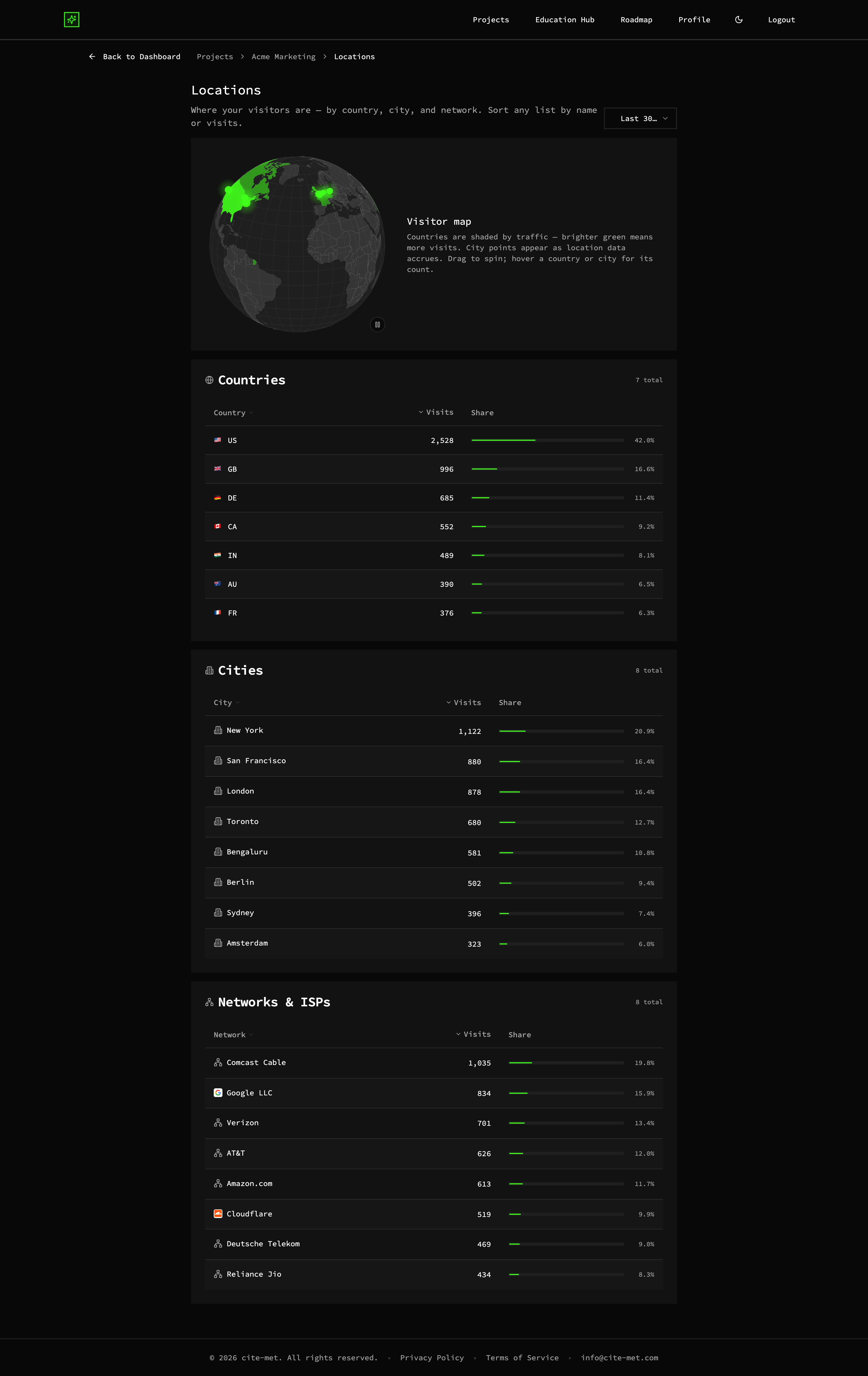
Interactive 3D globe shaded by traffic intensity with city-level points (demo data, illustrative)
City-level detail
Points and tables down to city and network, sortable.
No third-party calls
Rendered from self-hosted assets — your data doesn't leak to a map vendor.
Boardroom-ready
A genuinely fun view to show a client or an exec.
Why it matters
Instantly see where demand is concentrated, spot emerging markets, and back localization or ad-spend decisions with real geography — privately, since the map makes no third-party calls that would leak your visitor data.